|
We set off at 07.30 for the
six-hour trek through, up, down and on moraines. The massive ones were
the lateral moraines of the retreated Hunku glacier. The valley bottom
was covered in lakes and braided streams. The glacier itself ended in a
large lake, the ice beyond the lake was just visible in the cracks
below the mass of surface debris. Much of the rock was white granite,
with the occasional rusty sedimentary or metamorphosed boulders that
probably came from the obviously crumbly rock face on the west side of
the valley.
|
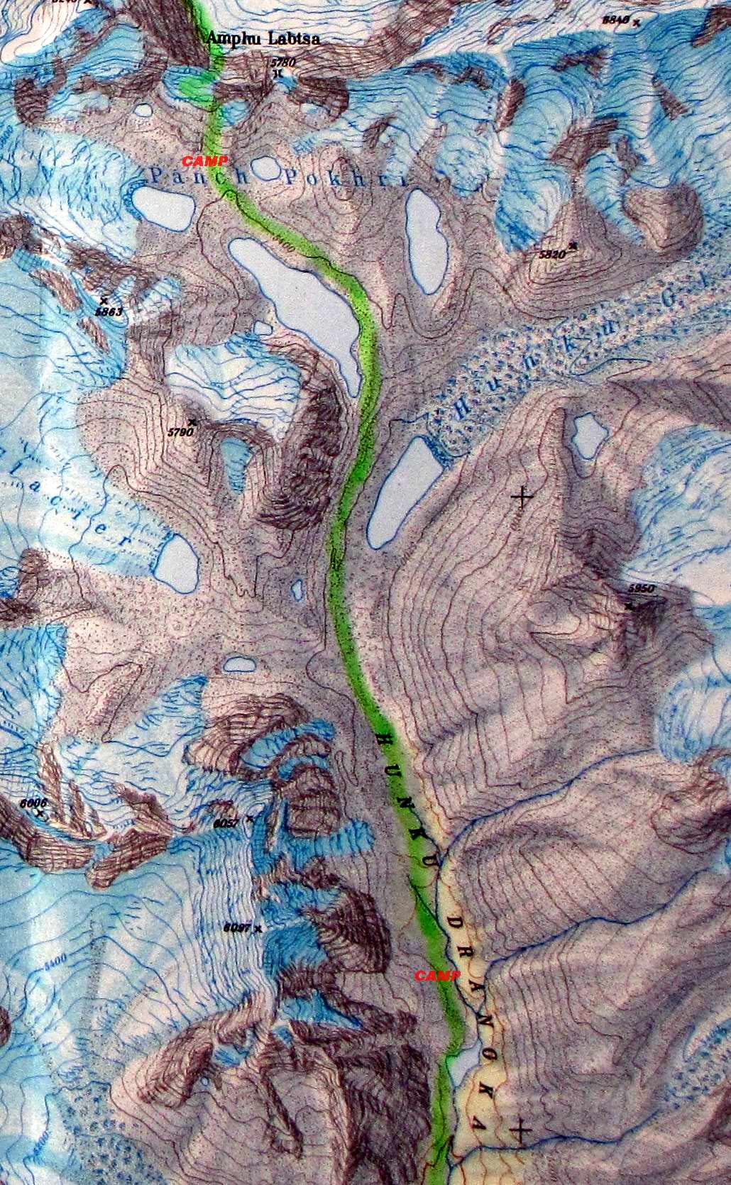
We climbed up the moraine
alongside the lake and then headed north to go along the eastern bank
of
the lake in the side valley, the Panch Pokhri. It was cold, despite
being in the sun since shortly after setting off, as there was an icy
wind. There was little shelter beside the lake where we had our packed
lunch - the usual biscuits with a slice of spam and cheese, and sort of
jam doughnut slice - greasy but nice.
|
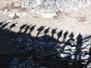
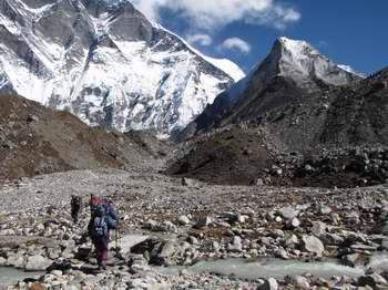
Setting off on the moraine in the morning sun
|
|
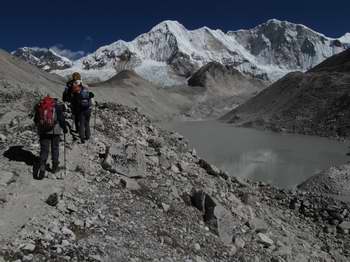
Climbing the moraine along the Hunku glacier lake
|
|
First sight of Amphu Lapcha pass
|
|
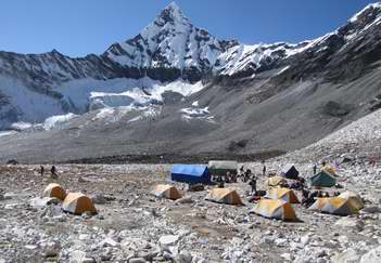
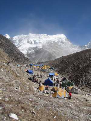
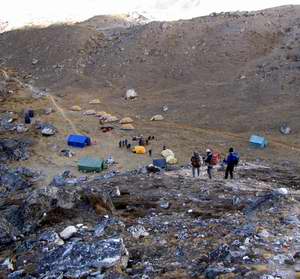
Camp site in Panch Pokhri valley
|
|
We then started ascending
through rocks towards the pass, the crevassed and terraced glacier
visible below the pass. After an hour or so we were met by two
cook-boys bearing hot squash - great! We knew the camp-site must
be near, and indeed it was only a further 20 minutes. The camp was
located in the bowl of the Panch Pokhri - a very sunny spot, so it was
very warm in the tent and mess tent, until the sun went down.
It was an idyllic spot, an almost complete bowl encircled by peaks and
glaciers. The dark rocks nearby had huge veins of white quartz
criss-crossing the face of the mountain. The route up to the pass
looked daunting.
Just before dark a group of four French trekkers arrived, heading in
the same direction. We were not so alone after all!
|
Thursday 29 October - over the Amphu Lapcha pass
|
|

|
The big day
for all, including the porters and cooks - no backing out here - as we have to cross the Amphu Lapcha (or
Labtsa as it is on the map) at 5780m. So an early start, bed tea at
04.30 and breakfast at 05.00. Set off at 06.00 in our mountain boots.
|
| After an hour of steep ascent on
rock and scree we stopped to put our
climbing harnesses and crampons on. I got excited about the geology
here as you could clearly see the contact zone between the white
granite and the original grey slatey rock, and further away to the east
was a clear geological fault line - but no time to investigate! |
Leaving camp to climb up to Amphu Lapcha
|
|
Climbing up through the glacier
|
|
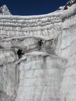
The first stage of the ascent
was to jumar up a crack in the lowest
terrace of the stepped glacier, followed by a level section before the
next jumar section up the fixed rope - how did the porters get up this
without jumars and crampons??? There were three jumar sections, after
which we roped up in groups of five and continued the exhausting climb
up through the ice to the pass which was marked by a cairn, prayer
flags and a precipitous drop on the far side. |
After a short break we started
off down the far side on very loose slatey rock and ice. However, we
had a safety rope to clip on to.
After an awkward scramble on rocks with our crampons still on we
reached the point from which the porters and all our luggage and
equipment had been lowered - for the process was finishing just as we
arrived, so we didn't have the anxiety of watching our belongings
disappear down the rope! Here we were lowered or abseiled for one
pitch and then abseiled down a further pitch - both on mixed ice and
rock.
|
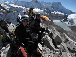
Margaret and Tish at the top of the pass
|
|
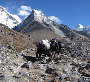
Porters waiting below the pass to collect the fixed
ropes
|
|
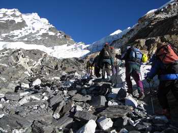
Below this there was another
series of safety ropes, until these ran
out and the descent continued on ice, snow, scree and rock - not easy.
It seemed to take ages to reach safety at the bottom of what was,
or
had been, the Amphu glacier and into a wasteland of moraine debris.
Here, at around 13.30 we stopped for our packed lunch, and to
change out of our mountain boots into lighter trekking boots - the
magical porters had brought the big blue bag over the pass for us.
The route continued through the lateral moraines of the Amphu glacier,
at one point the ground was covered in fine mica sand, so our boots and
socks twinkled for the next few days. As we headed north we had great
views of Lhotse and Lhotse Shar and the diminutive (in comparison)
Island Peak in front of them. In the main valley below instead of the
glacier shown on the map there is now a large green lake - in either
case it would be necessary for us to go down the Imja valley for about
3km before we could cross the valley to walk back up towards Island
Peak base camp.
|
Our camp was behind the lateral
moraine (behind which was the new lake), and was already in shade by
the time we arrived around 15.00.
Due to the cold we only left the tents for short, reluctant, periods -
like for soup and tea after we arrived, and then for dinner. It seemed
like the coldest night yet, with frost on the inside of the mess tent.
The dinner of pizza, rice, butter beans and sweetcorn was followed by
the best sweet served so far: stewed apple, cashew and raisins - with
the addition of a little rum or whisky (we had both on offer) - perfect.
Unfortunately, due to my excessive efforts to re-hydrate, I had to get
up three times during the night, but was rewarded by seeing the Pole
Star astride the point of Lhotse.
|
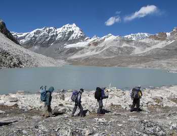
Walking into camp in the Imja valley
|
|