Granite Tor
landscape en route
|
The scenery didn't change before we got to Outjo, and a stop for coffee (along with a group of overlanders) and shopping. Then we began to head more to the west, and up towards Kamanjab. It was hot and dry again, and we had another picnic lunch under one of the only trees with shade on the whole C40 road.
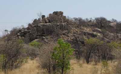
After Kamanjab isolated hills began to appear - knobbly granite lumps with sparse vegetation in the cracks in the rocks. By now we were on dirt roads, and heading towards the flat-topped Etendeka plateau.
The lodge is owned and run by the local community, and is located right on the edge of the plateau overlooking the Klip river valley. We were staying in individual stone huts, with water heated by adjacent 'donkeys' (iron boilers), burning wood. Stone paths linked the huts, with their uninterrupted views over the valley, to the main block with bar, lounge, dining room and swimming pool - almost paradise!
The evening meal was great, topped off with singing and dancing by the lodge staff.
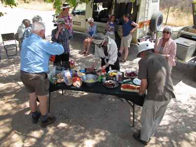
Picnic preparations
|
Monday 17 October
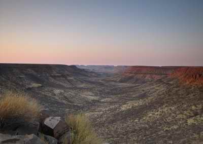 |
Dawn from Grootberg
lodge overlooking the Klip river valley
|
The original plan had been to walk on the plateau, but recent lion activity (and at least two people heard the lion in the night) meant that walking was off. So we had a game drive in Land Rovers around the plateau, with springbok, oryx, kudu and mountain zebra appearing in good numbers. More astonishing, however, was the red stony surface of the plateau, and the views out to the distant ridges - all flat topped with the same 132 million year-old lava flow. It was a very scenic and relaxing morning - followed by an even more relaxing afternoon, doing nothing except reading and a quick dip in the pool overlooking the Klip river valley.
For such a remote lodge the service and the food were exceptional, although the game steak was rather tough! A reduced 'choir' gave us a few songs after dinner again, but no repeat of the drunken 'Amarula' song.
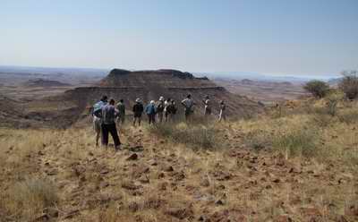 |
Gazing at the view from the Etendeka Plateau |
Tuesday 18 October
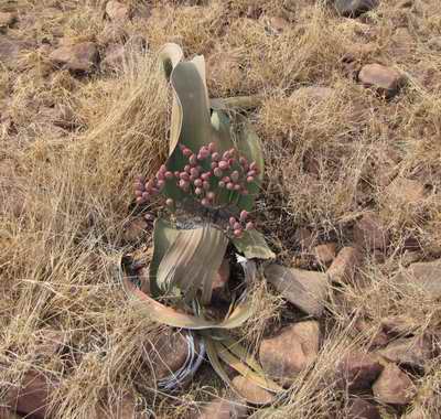 |
Welwitschia 'tree' (F)
|
It was back in the vehicles today to drive to the coastal town of Swakopmund for a sort of R&R - a journey of over 450 km without a trace of tarmac! The start was the most exciting - the 500m stony track off the plateau with stretches that were incredibly steep. After that is was just generally a corrugated road that at 80 kph gave you a reasonable back massage!
The road wound down off the plateau & then headed generally west below a series of flat topped ridges. The odd oryx and springbok appeared now & then. As we got further west the vegetation got less and less. Initially there were a few stunted mopane trees and acacia bushes, then clumps of a euphorbia bush, then very little at all. Hidden low among the rocks were some weird plants looking like floppy seaweed - these were Welwitschia mirabilis, a conifer related 'tree', with two leaves that grow continuously from a woody base & fray and wither at the ends. Male and female cones are on separate plants, and they can live for well over 1,000 years. As we got to the coast even the Welwitschias disappeared, to be replaced by sand, sand, gravel and just lichens and very low pink succulents.
After lunch we turned off the wonderfully smooth (after the previous roads) salt road to visit the fur seal colony at Cape Cross. The smell was overpowering, as was the noise - the breeding season begins in a month, and some huge bull seals seemed to be limbering up - head in the air, waving around threateningly. Half the seal population spread over the rocks seemed to be inert, and the other half hyper-active!
Back on the salt road it wasn't long before we reached Swakopmund, our home for two nights - and what a home, as we each had a self catering chalet and a complimentary bottle of wine!
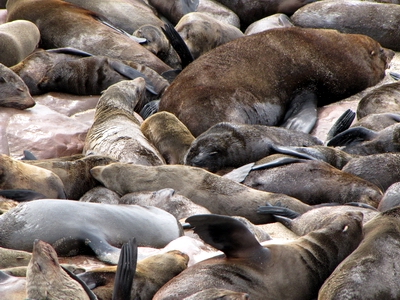 |
Cape Fur Seals |
Wednesday 19 October
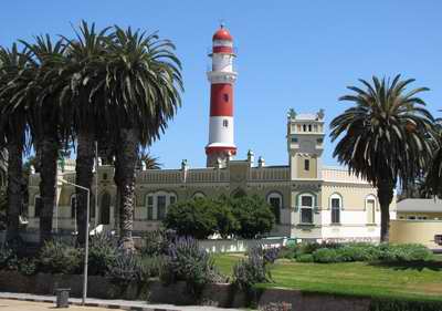 |
Swakopmund: Lighthouse and Kaiserliches
Bezirksgericht (State House)
|
A relaxing day, as it was a free day and the sun shone, and there was some of the complimentary wine left! For once we had breakfast after 07.00, and then went our separate ways to museums, shops, cafés and the beach. The town had a strange feel; here we are in Africa, but the architecture, language, food and drink were all distinctly German. The town was founded in the 1890's as a port for the German colony of South West Africa, as the nearby natural port of Walvis Bay belonged to the British. Many of the buildings from the first decade of the 20th century are still there, and beautifully restored. Despite the fact that the German colony ceased during the First World War, and South Africa administered Namibia after that (and illegally imposed apartheid here, and fought against Angola from bases here), the German influence seems to have persisted.
The role as a port was a failure as the harbour silted up, but the town is now a popular seaside resort.A high proportion of the visitors are German too. This had the advantage for us of ensuring a good selection of coffee and cake houses, and also a fine beer selection in the Brauhaus for lunch.
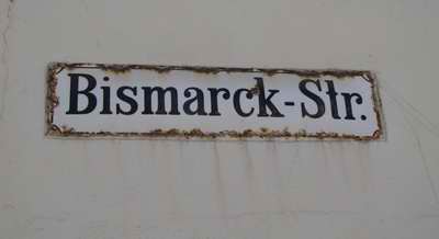 |
Street name in Swakopmund
|
Thursday 20 October
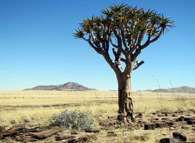 |
Quiver Tree |
Another day on the road, and apart from a few kilometres in Walvis Bay it was a dirt road all the way.. For the first time it was cloudy and misty in the morning, but once we headed inland the clouds dispersed, the windows in the vehicles de-misted, and we were warm again.
It was a fascinating journey through desert and semi-desert landscape. At first it was flat gravel desert, then as we approached the line of mountains that stretch down Namibia around 100 km inland the rock strata began to appear through the sand. Some water must exist below the surface as the odd line of Camelthorn trees appeared. We stopped at one point where there were three quiver trees arranged photogenically above the plain.
Shortly afterwards we stopped again where the Kuiseb River, dry at this time of year, had carved a gorge in the tortured strata. As we headed south the isolated mountain blocks on either side of the road got higher and higher. the rocks were generally red, but lines of dark and light rocks appeared in places, Dry grass covered the plains, burnt black in places. Springbok sprung away from the road from time to time, and distant black blobs turned into ostriches.
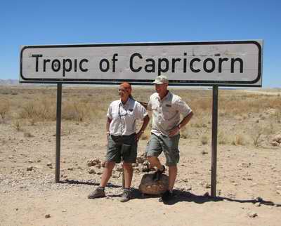
After a lunch at a lodge in Solitaire (with old car carcasses artistically arranged around the car park), we continued south (across the Tropic of Capricorn) to the Hammerstein Lodge for a two-night stay. Located in a dusty dry valley the only water comes from a bore-hole - but at least there was enough to fill a small circular swimming pool with cold but milky water - bliss in there after the hot journey.
At sunset the hills to the east turned blood red.
 |
Chantel & Todd, our driver/guides |