Monday 19 October


route map


Woke up feeling well again and eagerly attacked breakfast (with the exception of the hard-boiled egg). The morning was cloudy, and the clouds were clinging around the peaks as we set off up above the berberis and rhododendron line and into a rocky landscape of  low heath plants - not unlike North Wales in fact. We spotted our first pale trumpet gentians of the trip. Stretches of the path had been recently improved into a series of rock steps, but other stretches reverted to rough and stony in nature so that concentration on
ones feet was essential.

on the trail

Walking in North wales?

porters on the trail

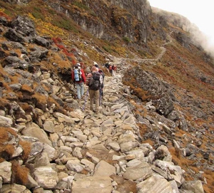
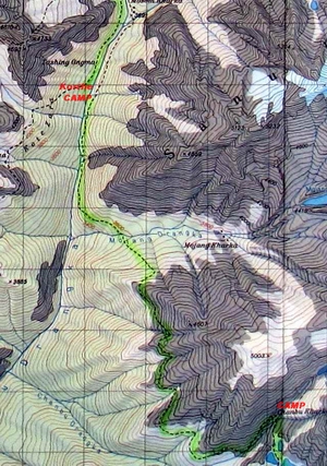
Porters on the trail

As there was no place for the cook-boys to produce a cooked lunch we each were given a packed lunch with (another) hard-boiled egg, biscuits, cake and an apple. We reached an altitude of 4,400m before dropping down past a series of lakes to 4,200m at our camp-site at Chambu Kharka.
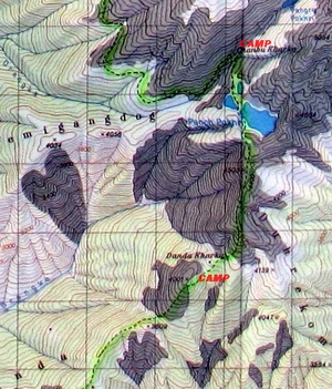
The site was in the bowl of a huge corrie with a waterfall cascading over dark rocks from a higher corrie.  Above this corrie a snowy peak disappeared into the clouds. Spectacular!  As it was only 12.30 when we arrived we were served with a welcome noodle soup, and then spent the afternoon reading, writing and washing clothes. Then the temperature began to fall, making the new after dinner ritual of filling our Sigg bottles with boiling water and stuffing them in our sleeping bags very welcome. It even began to snow and somehow, although it was only 19.30, we stayed in bed warm and cosy

camp site location

Camp site in the corrie at Chambu Kharka


Tuesday 20 October


route map
In the morning it was freezing outside and just 1°C inside the tent - our first really cold morning. Despite this the sherpas had taken the mess tent down, so we had to have an al fresco breakfast.

The cloud had gone, but the site was still in the shade; we watched the shadow on the hillside gradually shrinking, and we only had to walk for 10 minutes before we were in the full sun. The challenging Alpine style trail contoured around the mountainside high above the Hinku valley with extensive views, including back across the valley to the ridge we had descended  four days earlier.

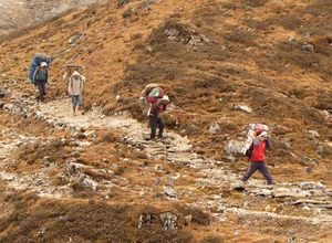
Eventually the path began to drop and the amount of rhododendrons increased until we were under the canopy of large rhododendrons and other trees growing amidst  huge boulders. The path had a real jungle feel with mosses and epiphytes hanging from the trees. we were also getting hungry, having been getting used to lunch around 11.00 - and it was 12.30 and no sign of our large blue plastic sheet or the cook-boys. We had already passed a group of porters cooking up their lunch by the path.
Suddenly we were ambushed on the path by the head cook, Biri, and a cook-boy with  large kettles full of hot orange drink. He explained that they had been unable to find a suitable spot to cook (I think the Dutch group had bagged the only possible spot before us!) and had had to descend all the way to the Hinku river. A little later as we descended we met the sherpas bringing our lunch up to meet us, so we squatted on fallen tree trunks by the path and tucked into the delights of naan bread, baked beans, spam, cheese and curried potatoes.
Eventually we reached the valley bottom and began ascending the valley through the alluvial  and morainic debris scattered above the torrent itself. Old tall pine trees, many dead, were growing here and there amongst the debris.
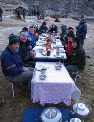
Cool breakfast

Chilly breakfast


hot drinks

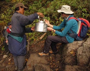
Hot orange squash time


After a further two kilometers we reached a bridge to cross the river and reach the extensive village of Korthe.  This was a bit of a mystery as the trail shown on the map stayed on the east side of the river, and there was no village marked on the map. However it was the largest village we had seen so far, with many dry-stone walled lodges each advertising hot showers, heated rooms, and meals (in a variety of spelling) and usually with a small shop too. Further construction was under way and carpenters were planing wood on a couple of them .
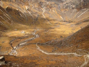
We were camping on a terrace between a couple of lodges, and had our meals in the lounge of one of them. The view from the terrace at sunset, with Mera Peak in the distance, was heart stopping - an unfortunate phrase as one of our group, Mike, decided he had to abandon the trek as he had notice irregularities in his heart beat and he suffers from high blood pressure in any case.
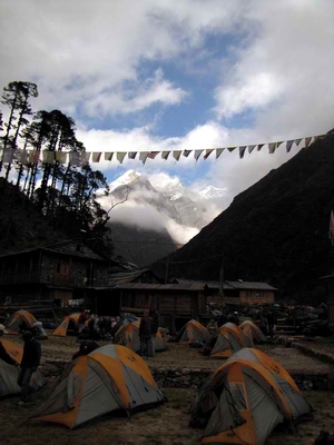
  View from Korthe

Camp site at Korthe

porters cooking

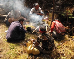
Porters cooking their lunch


Wednesday 21 October


route map We woke to a beautiful clear morning with frost on the tents. Luckily breakfast was served in the lodge dining room, warm although the  windows were only 'glazed' with sheets of transparent plastic. So we were well wrapped up when we set off at 07.45, picking our way upstream through a labyrinth of river gravel, boulders and glacial moraine rocks of enormous size. 
At times large alluvial fans spread out from the valley sides to join the chaos.
The shrubs gradually gave way to low down bushes of berberis, cotoneaster, juniper and willow interspersed with gentians and edelweiss.
The view up the valley to the peaks was spectacular and enjoyable once we had walked into the sun and peeled off several layers. The original itinerary included a side trip to the lake, Dudh Kund, below Mera Peak. However the trail & the village of Mosom Kharka, had been washed away in floods, so we carried straight up the main valley to an early lunch stop at Gondishang
The temperature began to fall after lunch as wisps of cloud drifted across the sun. We called in on a small monastery tucked under an overhanging rock, where a single monk chanted continually whilst we shuffled round the peaceful room and some of the sherpas prostrated themselves before the 'altar'. I was, however,  somewhat puzzled at the reasons for the carcas of an eagle hanging from the wall.

following the river

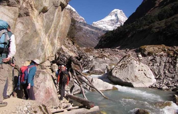
Picking our way up-river
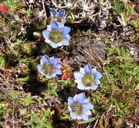
Gentians

Gentians


spreadeagled

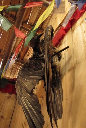
Spreadeagled in the monastery

We arrived at Tangnag  around 14.30 to be reunited with our mountain boots and climbing kit, and then spent a chilling hour in the fresh breeze having our kit re-checked by the sherpas. A multitude of minor adjustments were made to our crampons, prussic loops, and jumar attachments before we were deemed to be in order. We then spent some time trying to get warm again in our tents, before dashing to the mess tent with frost already covering the outer tent fabric. As the cook had been able to re-stock we had cauliflower and green beans to adorn the other items: rice, curried potatoes, dahl, sauce and pizza (pizza? how do you cook that on a primus stove?), followed by clementines.

Another pattern established itself during the night - on the two to three occasions when I had to get up in the night to pee (one side effect of altitude & drinking lots to avoid dehydration) I would note the position of Orion as it spun across the sky - by the end of the trek I could almost tell the time by its position!
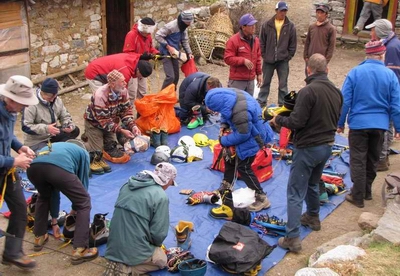
checking kit

Checking kit

Back to top
To previous log
Next log